![]()
![]()
![]()
e-shop kategórie
-
Nástenné mapy
- doplnky ku mapám
- stieracie mapy
- drevené mapy WOOD
- tapety
- svet
- kontinenty
- slovensko mapy
-
štáty
- Afganistan
- Albánsko
- Alžírsko
- Arménsko
- Austrália
- Azerbajdžan
- Bangladéš
- Belgicko
- Bhutan
- Bosna a Hercegovina
- Brazília
- Bulharsko
- Čierna Hora
- Česká republika
- Čína
- Dánsko
- Egypt
- Estónsko
- Filipíny
- Fínsko
- Francúzsko
- Grécko
- Gruzínsko
- Holandsko
- Chorvátsko
- India
- Indonézia
- Irak
- Irán
- Írsko
- Island
- Izrael
- Japonsko
- Jemen
- Jordánsko
- Kambodža
- Kanada
- Kazachstán
- Kórea
- Kosovo
- Kostarika
- Kuba
- Kyrgyzstán
- Libanon
- Litva
- Lotyšsko
- Luxembursko
- Lýbia
- Macedónia
- Maďarsko
- Malajzia
- Mauricius
- Mexiko
- Moldavsko
- Mongolsko
- Nemecko
- Nepál
- Nórsko
- Nový Zéland
- Omán
- Pakistan
- Poľsko
- Portugalsko
- Rakúsko
- Rumunsko
- Rusko
- Saudská Arábia
- Slovensko
- Slovinsko
- Spojené Arabské Emiráty
- Srbsko
- Sýria
- Španielsko
- Švédsko
- Švajčiarsko
- Tadžekistan
- Taliansko
- Thajsko
- Turecko
- Turkmenistan
- Ukrajina
- USA
- Uzbekistan
- Veľká Británia
- Vietnam
- Viac
- mestá
- špedičné a PSČ mapy
- politické mapy
- fyzické mapy
- panoramatické mapy
- reliéfne 3D mapy
- satelitné a ortofoto mapy
- historické mapy
- detské mapy
- vesmír
- Všetky podkategórie
- Glóbusy
-
Turistika
- Albánsko
- Argentína
- Bulharsko
- Čierna Hora
- Česká republika
- Dánsko
- Estónsko
- Francúzsko
- Grécko
- Gruzínsko
- Chile
- Chorvátsko
- India
- Írsko
- Južná Afrika
- Keňa
- Lesotho
- Litva
- Lotyšsko
- Maďarsko
- Maroko
- Nemecko
- Nepál
- Nórsko
- Portugalsko
- Rakúsko
- Rumunsko
- Rusko
- Slovensko
- Slovinsko
- Srbsko
- Svazijsko
- Španielsko
- Švajčiarsko
- Švédsko
- Taliansko
- Tanzánia
- Turecko
- Veľká Británia, Škótsko
- Uganda
- Ukrajina
- USA
- Všetky podkategórie
- Cykloturistika
- Atlasy
-
EURÓPA
- Albánsko
- Andorra
- Belgicko
- Bielorusko
- Bosna a Hercegovina
- Bulharsko
- Cyprus
- Česká republika
- Čierna Hora
- Dánsko
- Estónsko
- Fínsko
- Francúzsko
- Gibraltar
- Grécko
- Holandsko
- Chorvátsko
- Írsko
- Island
- Kosovo
- Lichtenštajnsko
- Litva
- Lotyšsko
- Luxembursko
- Macedónsko
- Maďarsko
- Malta
- Moldavsko
- Nemecko
- Nórsko
- Poľsko
- Portugalsko
- Rakúsko
- Rumunsko
- Rusko
- Slovensko
- Slovinsko
- Srbsko
- Španielsko
- Švajčiarsko
- Švédsko
- Taliansko
- Turecko
- Ukrajina
- Veľká Británia
- Všetky podkategórie
-
ÁZIA
- Ázia regióny
- Afganistan
- Arménsko
- Azerbajdžan
- Bahrajn
- Bangladéš
- Bhután
- Cyprus
- Čína
- Filipíny
- Gruzínsko
- India
- Indonézia
- Irak
- Irán
- Izrael
- Japonsko
- Jemen
- Jordánsko
- Kambodža
- Katar
- Kazachstan
- Kórea
- Kuvajt
- Kyrgyzstán
- Laos
- Libanon
- Malajzia
- Maledivy
- Mongolsko
- Myanmar
- Nepál
- Omán
- Pakistan
- Palestína
- Rusko
- Saudská Arábia
- Singapur
- Spojené arabské emiráty
- Srí Lanka
- Sýria
- Tadžekistan
- Taiwan
- Thajsko
- Tibet
- Turecko
- Turkmenistan
- Uzbekistan
- Vietnam
- Východný Timor
- Všetky podkategórie
-
AFRIKA
- Afrika regióny
- Alžírsko
- Angola
- Benin
- Botswana
- Burkina Faso
- Burundi
- Čad
- Džibutsko
- Egypt
- Eritrea
- Etiópia
- Gabon
- Gambia
- Ghana
- Guinea
- Guinea-Bissau
- Juhoafrická republika
- Kamerun
- Kapverdy
- Keňa
- Komory
- Kongo
- Lesotho
- Líbya
- Madagaskar
- Malawi
- Mali
- Maroko
- Mauretánia
- Mauricius
- Mozambik
- Namíbia
- Niger
- Nigéria
- Pobrežie Slonoviny
- Réunion
- Rwanda
- Sao Tome & Principe
- Senegal
- Seychely
- Sierra Leone
- Somálsko
- Stredoafrická republika
- Sudán
- Svazijsko
- Tanzánia
- Togo
- Tunisko
- Uganda
- Zambia
- Zimbabwe
- Všetky podkategórie
-
AMERIKA
- Amerika severná
- Amerika stredná a Karibik
- Amerika južná
- AUSTRÁLIA a PACIFIK
- ANTARKTÍDA a ZEMSKÉ PÓLY
- Zobraziť všetky
- Zobraziť viac
 |
|
____________________________________
POŠTOVNÉ vrámci ____________________________________ |
|
PREPRAVNÁ SPOLOČNOSŤ do 9,99 € ... 3,50 € nad 10,00 € ... 5,50 €
........................................................................... platba prevodom ..... 0,00 € platba platobnou bránou ..... 0,00 € platba dobierkou ..... 2,00 €
PACKETA výdajné miesto poštovné+balné ... 3,00 € LEN TOVAR dĺžka strany do 70cm ........................................................................... platba prevodom ..... 0,00 € platba platobnou bránou ..... 0,00 € platba dobierkou ..... 2,00 €
|
|
|
|
____________________________________
POŠTOVNÉ vrámci ____________________________________ |
|
PŘEPRAVNÍ SPOLEČNOST do 9,99 € .... 6,00 € nad 10,00 € ... 9,00 € ........................................................................... platba převodem ..... 0,00 € ........................................................................... PACKETA výdejní místa POUZE BALÍK délka strany do 70cm postovne+balné ... 5,20 € ........................................................................... platba převodem ..... 0,00 € platba dobírkou .... 2,00 € Důležité upozornění
Pro platbu v Kč objednávejte v eshopu www.worldmaps.cz. Bude Vám automaticky vystavena faktura v Kč, pro české firmy plátce dph v Kč bez dph.
Pro platbu v € objednávejte v eshopu www.worldmaps.sk. Stačí v košíku při dokončení objednávky zakliknout dodání vrámci EU. Bude Vám vystavena faktura v €, pro české firmy plátce dph v € bez dph.
Pokud jste již objednávku udělali v eshopu worldmaps.sk, a chcete platit v Kč, napište info do poznámky na konci objednávky, nebo pošlete email na info@worldmaps.sk. Zašleme Vám fakturu v Kč.
|
|
|
|
____________________________________
POSTAGE within ____________________________________ |
|
SHIPPING COMPANY up 9,99 € .... 6,00 € 10,00 € and more .... 9,00 € ........................................................................... payment by transfer .... 0,00 € ........................................................................... PACKETA Z-POINT ONLY package size up 70cm Z-POIT´s
delivery+packaging ... 5,20 € ........................................................................... payment by transfer ..... 0,00 € |

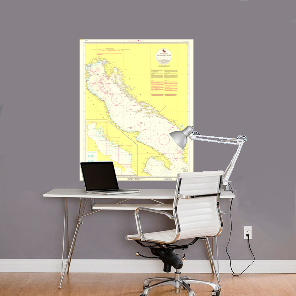
Úvod » Nástenné mapy » nástenná mapa Jadranské more 107x86cm, 1:800tis námorná mapa lamino, lišty
nástenná mapa Jadranské more 107x86cm, 1:800tis námorná mapa lamino, lišty

SKLADOM
Tweet
Vaše hodnotenie:
Ďakujeme za Vaše hodnotenie
Ďakujeme za Vaše hodnotenie
0x
POPIS POLOŽKY
| typ: | laminovaná nástenná mapa s plastovými lištami | ||
| jazyk: | originál jazyk jednotlivých krajín | ||
| dátum vydania: | 2015 | ||
| formát: | 107 x 86 cm | ||
| mierka: | 1:800.000 | ||
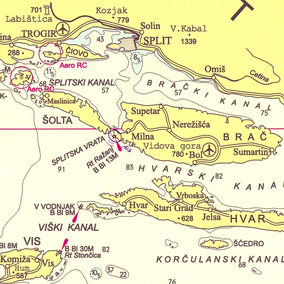
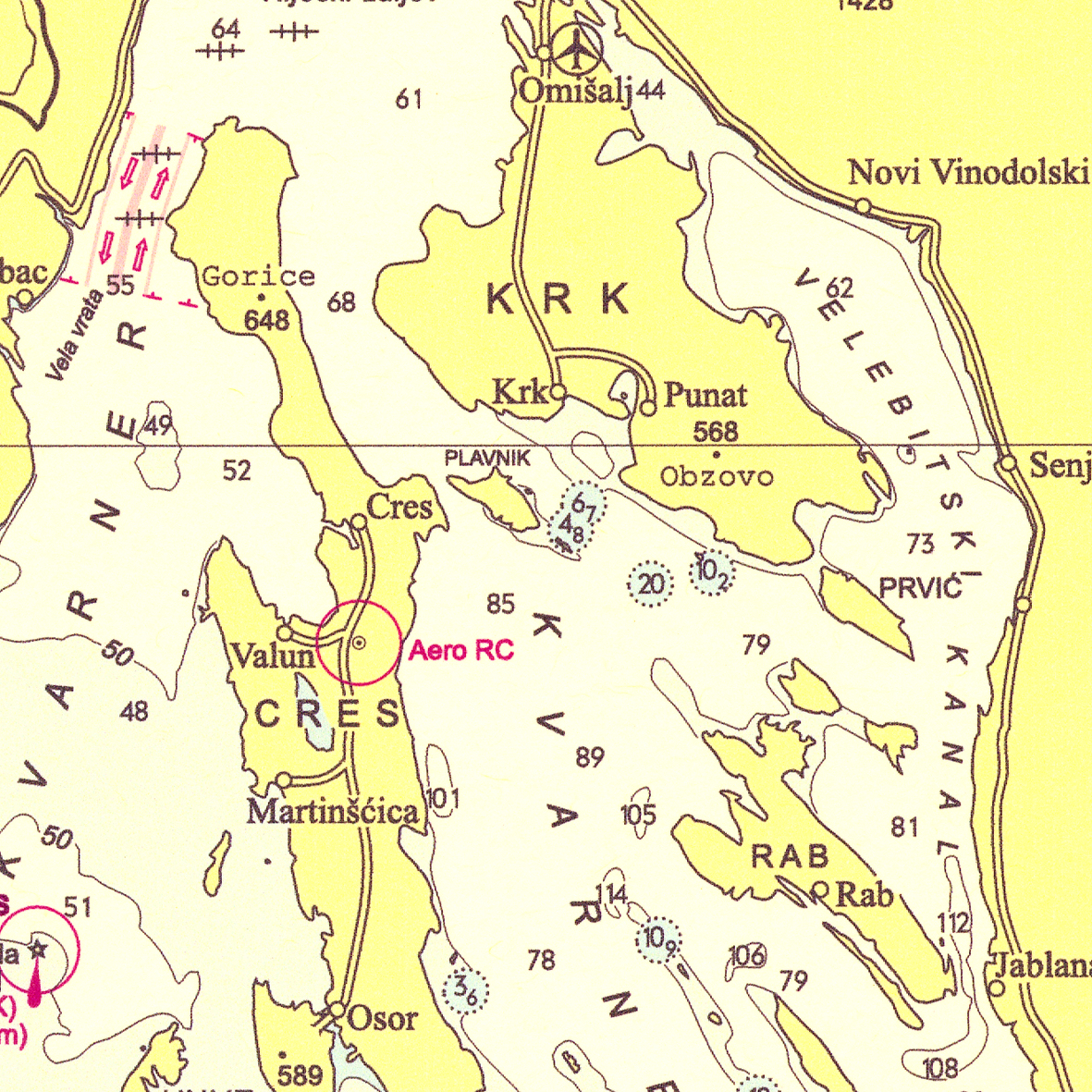
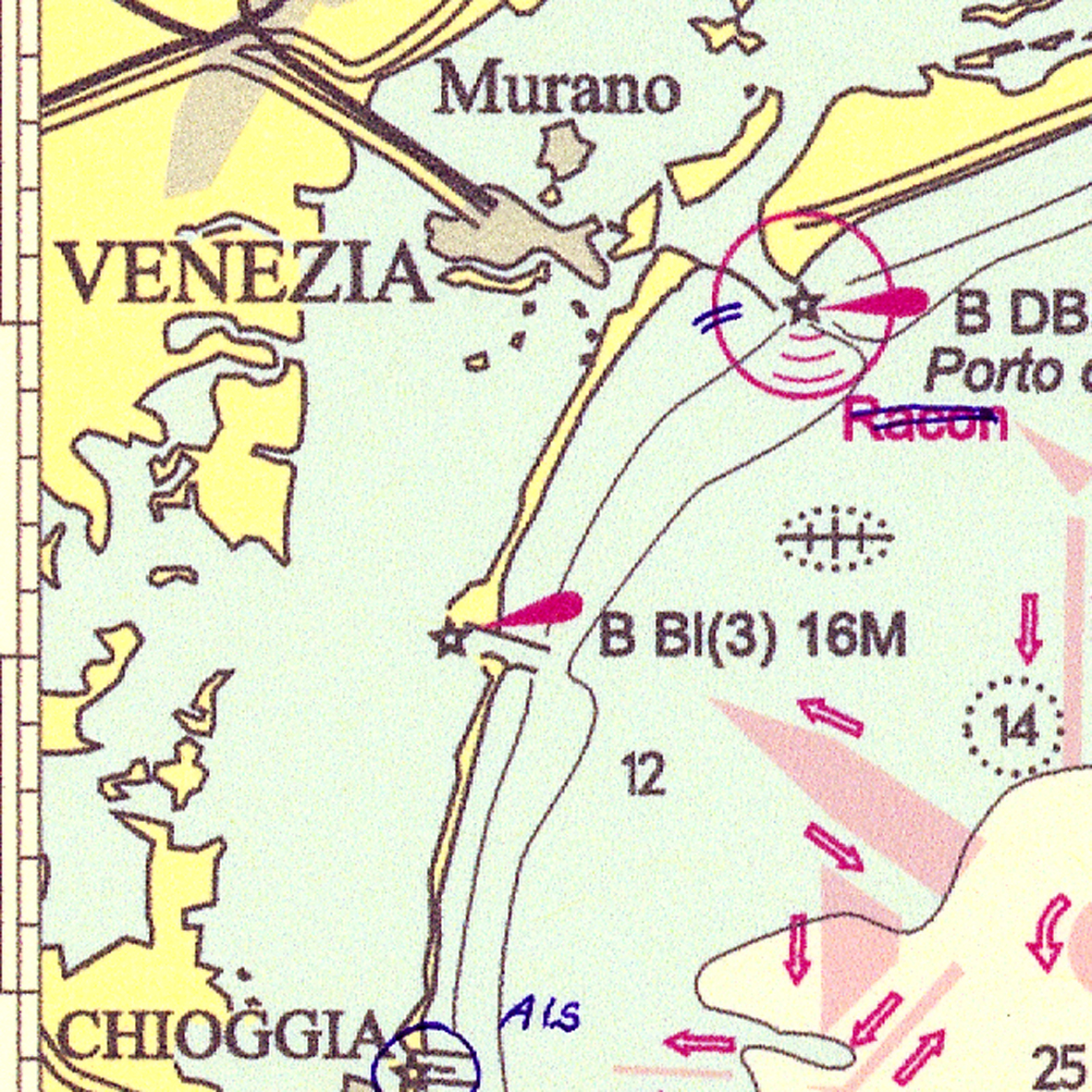
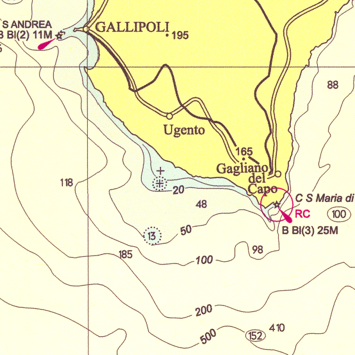
Jadranské more nástenná laminovaná mapa v mierke 1:800tis, vo formáta A0. Celkový pohľad na Jadranské more. Projekcia Mercator, Elipsoida Bessel.
Prvá edícia bola v r.1998, druhá edícia 2005 a reprint s aktualizáciou apríl 2015.
Mapa pokrýva oblasť: sever 46º35’, východ 19º45’, juh 39º25’, západ 12º10’
-
Edition date (first edition, new edition, reprint) implies that the chart is updated with the latest edition of NtM prior to that date. Exact date of the chart update is shown in the left bottom margin of chart under the heading Small corrections.
-
Chart limits do not necessarily show actual situation in certain cases. Some charts do not have a rectangular coverage or a north-south orientation.
-
Charts are updated with official (paper) editions of the publication Notices to Mariners. Informative and auxiliary charts are not updated with NtM.
-
Under NtM, it is indicated whether a chart is updated with NtM. If so, all NtM editions containing corrections for that chart are listed. Only corrections with a date later than the edition date given on chart shall be applied.
- Explanation of marks: YES – Chart is subject to maintenance through NtM NO – Chart is not subject to maintenance YES* - Chart is contained within another chart, being updated through updates of that chart (see Contained in) YES** - Chart folio, where charts contained within that folio are updated separately (see Chart components)
Mapa laminovaná s bielymi plastovými lištami
|
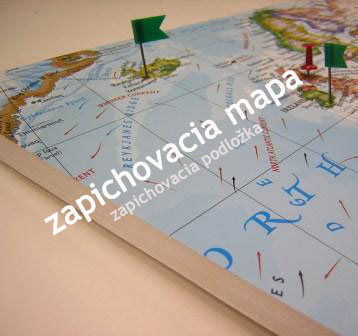
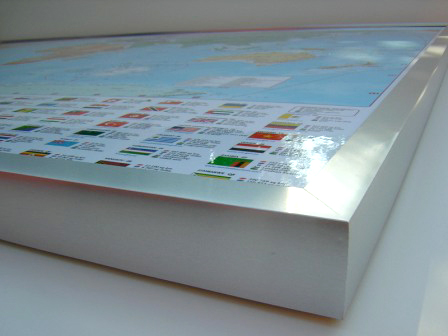
Mapu dodávame aj v iných variantoch:
| zapichovacia bez rámu |
 |
| zapichovacia rámovaná mapa |
 |